-

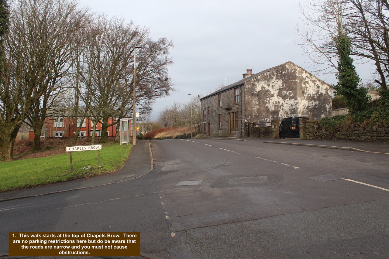
- 1. This walk starts at the top of Chapels Brow. There are no parking restrictions here but do be aware that the roads are narrow and you must not cause obstructions.
-

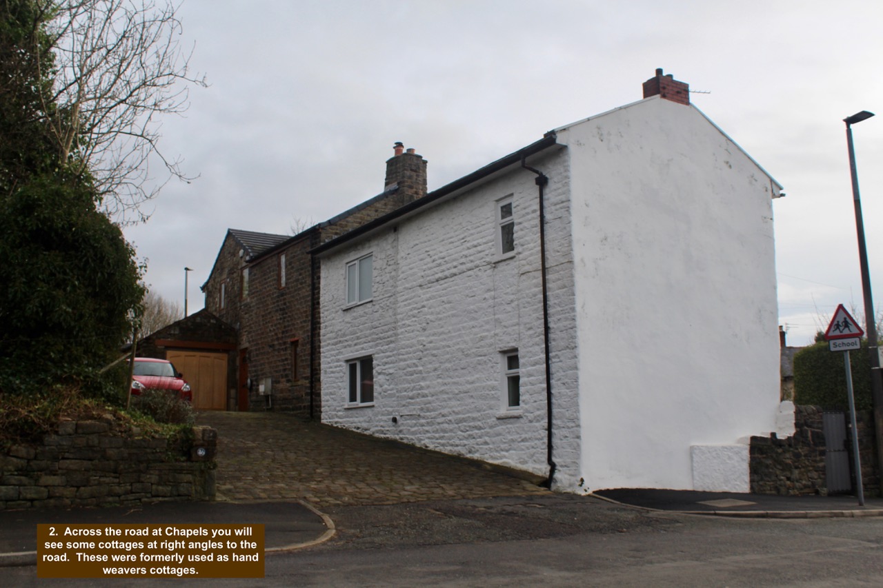
- 2. Across the road at Chapels you will see some cottages at right angles to the road. These were formerly used as hand weavers cottages.
-

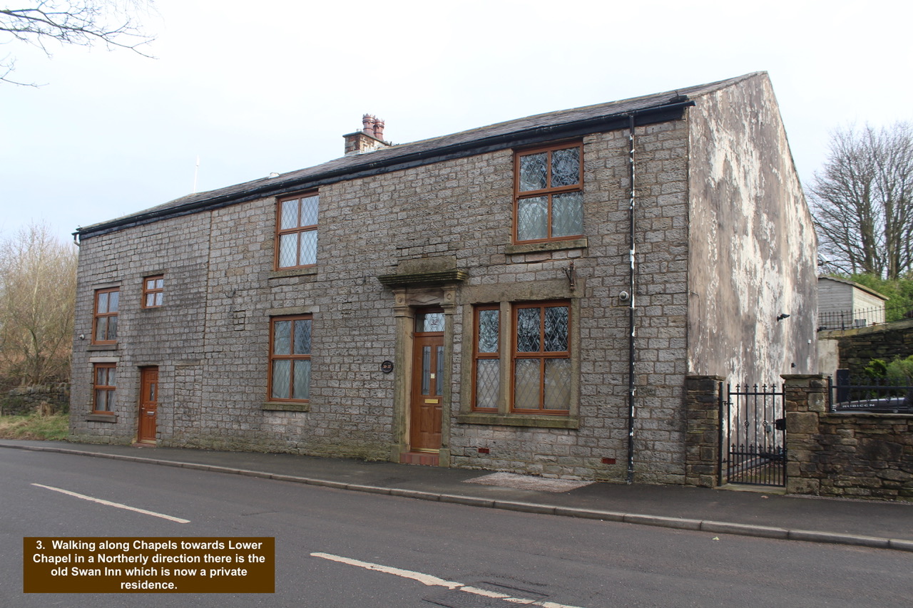
- 3. Walking along Chapels towards Lower Chapel in a Northerly direction there is the old Swan Inn which is now a private residence.
-

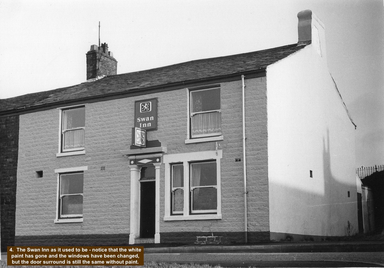
- 4. The Swan Inn as it used to be – notice that the white paint has gone and the windows have been changed, but the door surround is still the same without paint.
-

- 5. Some of the locals from the Swan Inn circa 1914 with a soldier in uniform central. It would have been a good time to be a flat cap retailer.

-

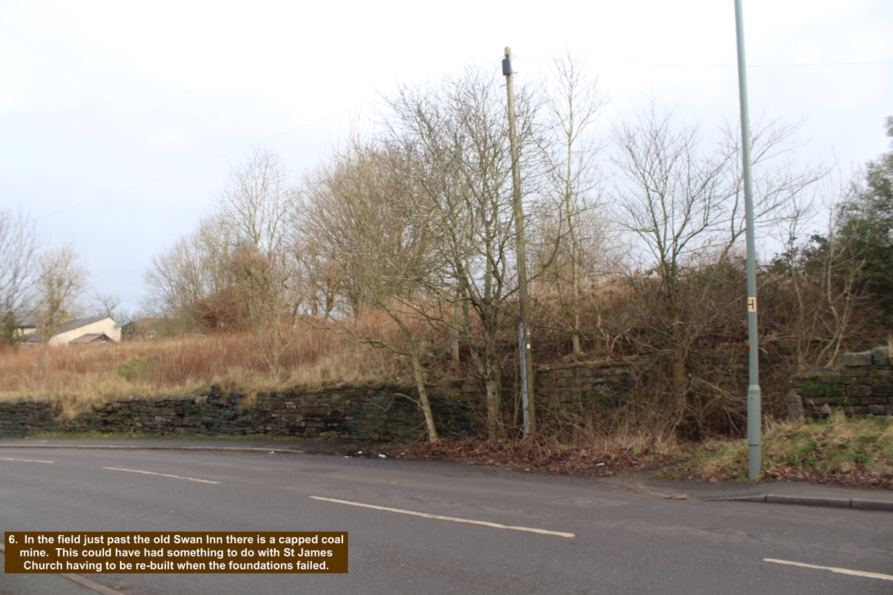
- 6. In the field just past the old Swan Inn there is a capped coal mine. This could have had something to do with St James Church having to be re-built when the foundations failed.
-

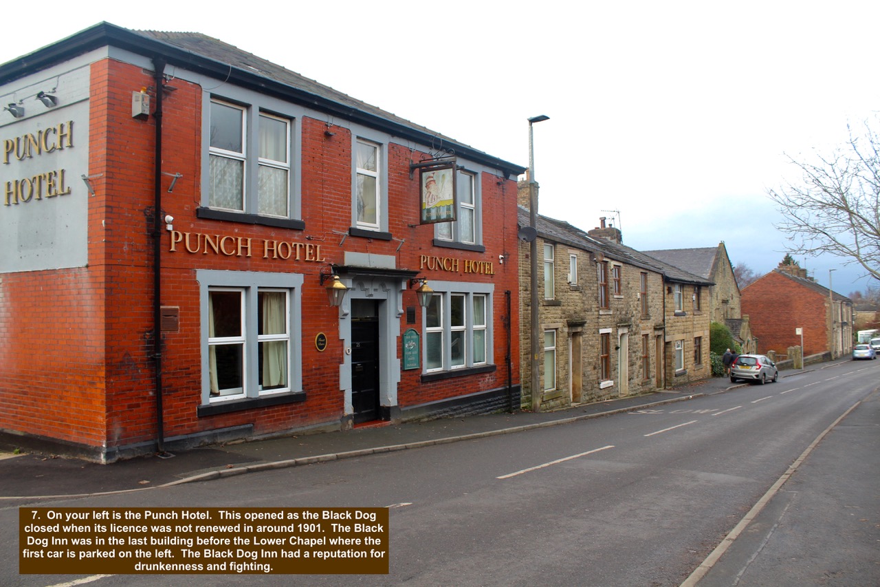
- 7. On your left is the Punch Hotel. This opened as the Black Dog closed when its licence was not renewed in around 1901. The Black Dog Inn was in the last building before the Lower Chapel where the first car is parked on the left. The Black Dog Inn had a reputation for drunkenness and fighting.
-

- 8. Lower Chapel was established as the third place of worship in Over Darwen by the Non-Conformist Movement. They had previously used St James as we know it or Over Darwen Chapel as it was at the time. Their first place of Worship was Plane Tree Barn which was just after the School going down Goose House Lane. The earliest date stone on the front of the this building is 1719.

-

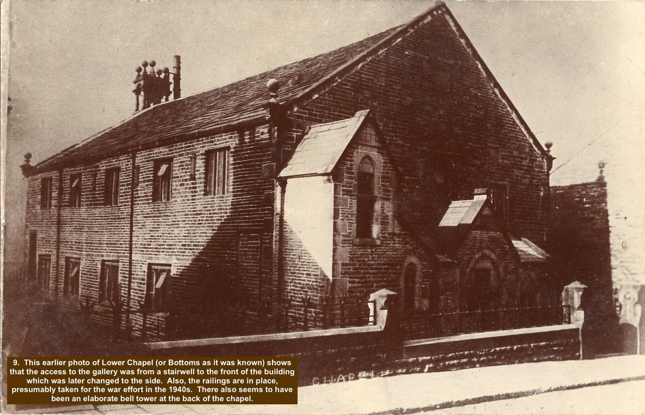
- 9. This earlier photo of Lower Chapel (or Bottoms as it was known) shows that the access to the gallery was from a stairwell to the front of the building which was later changed to the side. Also, the railings are in place, presumably taken for the war effort in the 1940s. There also seems to have been an elaborate bell tower at the back of the chapel
-

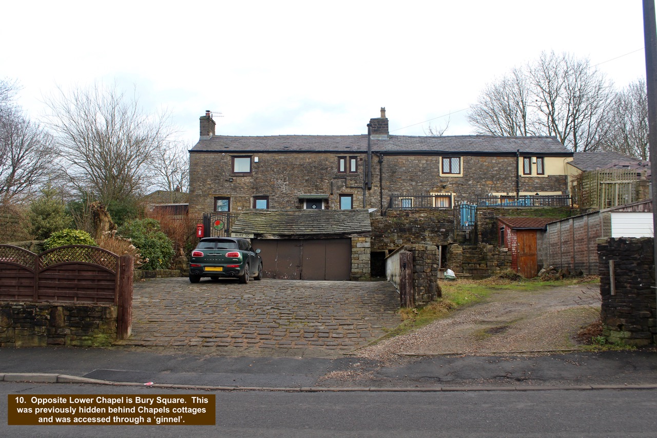
- 10. Opposite Lower Chapel is Bury Square. This was previously hidden behind Chapels cottages and was accessed through a ‘ginnel’.
-

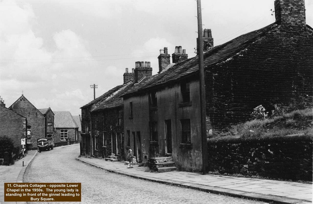
- 11. Chapels Cottages – opposite Lower Chapel in the 1950s. The young lady is standing in front of the ginnel leading to Bury Square.
-

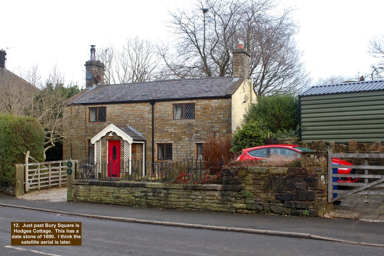
- 12. Just past Bury Square is Hodges Cottage. This has a date stone of 1690. I think the satellite aerial is later.
-

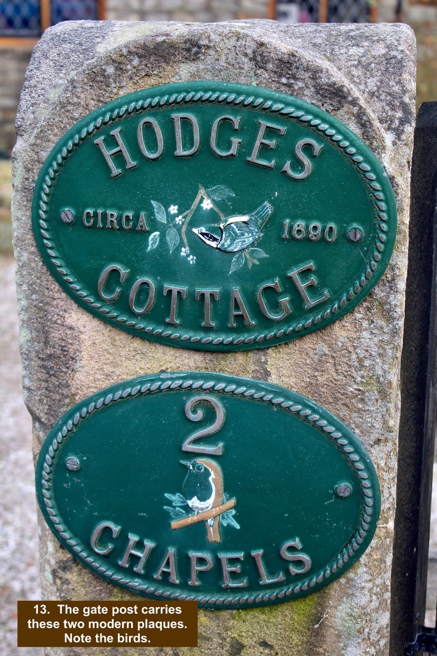
- 13. The gate post carries these two modern plaques. Note the birds.
-

- 14. Across the road from Hodges Cottage is a row of houses. The first one in the row starting from the left has the original leaded light above the door. Note the bird.

-

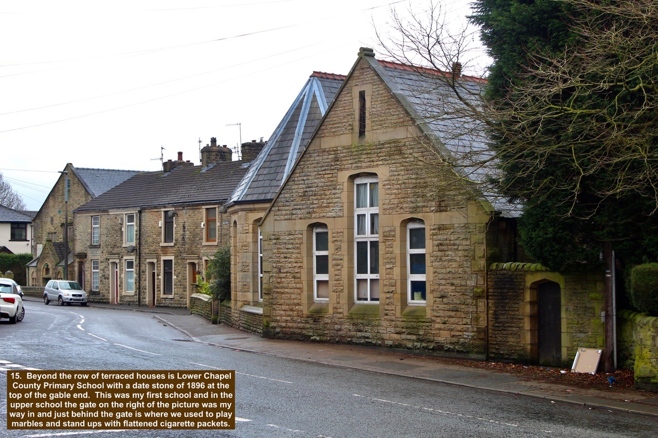
- 15. Beyond the row of terraced houses is Lower Chapel County Primary School with a date stone of 1896 at the top of the gable end. This was my first school and in the upper school the gate on the right of the picture was my way in and just behind the gate is where we used to play marbles and stand ups with flattened cigarette packets.
-

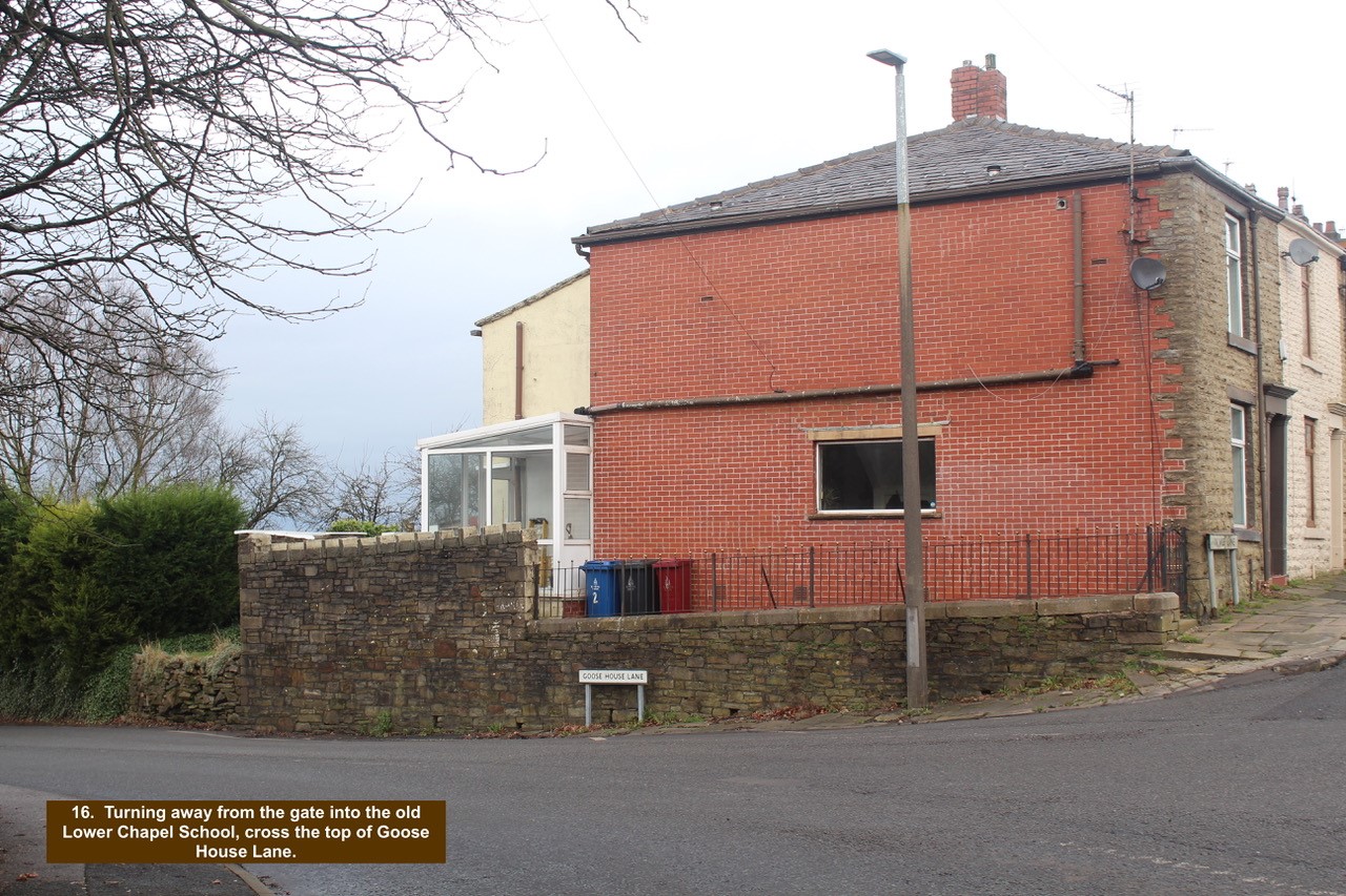
- 16. Turning away from the gate into the old Lower Chapel School, cross the top of Goose House Lane.
-

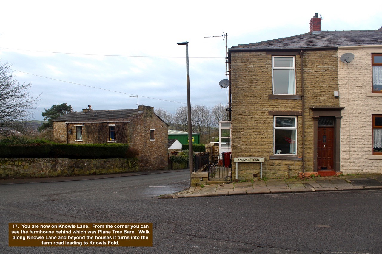
- 17. You are now on Knowle Lane. From the corner you can see the farmhouse behind which was Plane Tree Barn. Walk along Knowle Lane and beyond the houses it turns into the farm road leading to Knowls Fold.
-

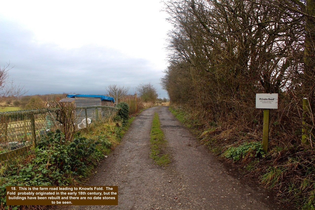
- 18. This is the farm road leading to Knowls Fold. The Fold probably originated in the early 18th century, but the buildings have been rebuilt and there are no date stones to be seen.
-

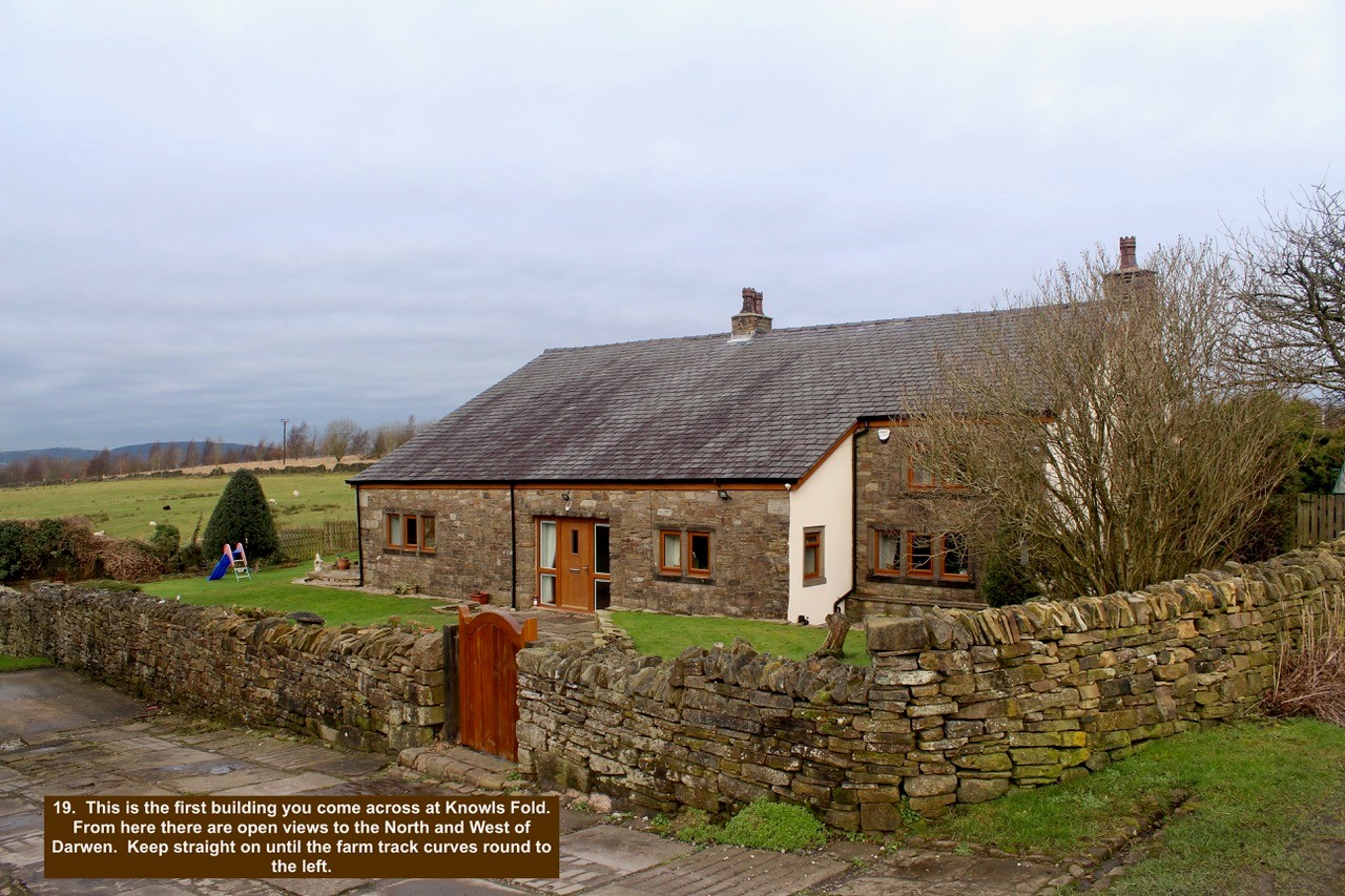
- 19. This is the first building you come across at Knowls Fold. From here there are open views to the North and West of Darwen. Keep straight on until the farm track curves round to the left.
-

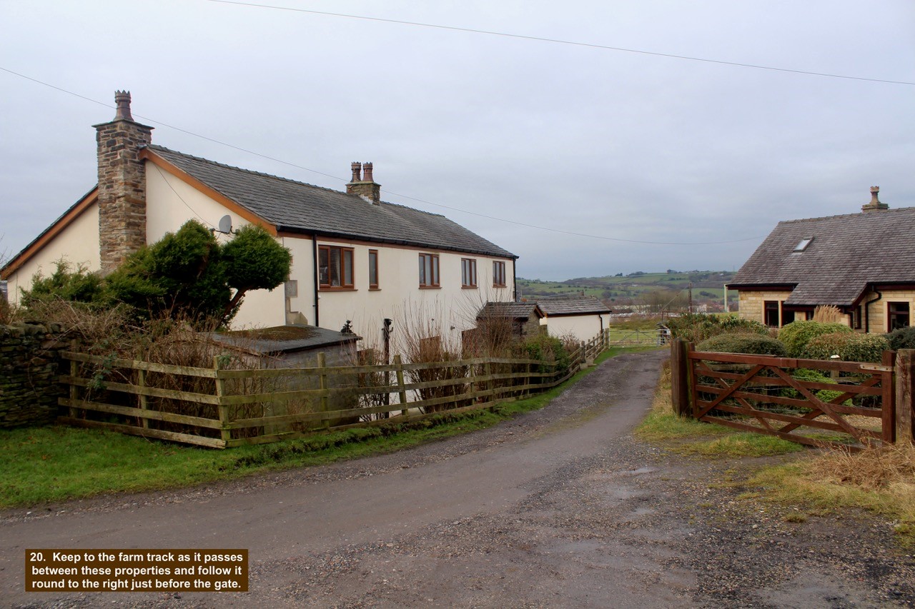
- 20. Keep to the farm track as it passes between these properties and follow it round to the right just before the gate.
-

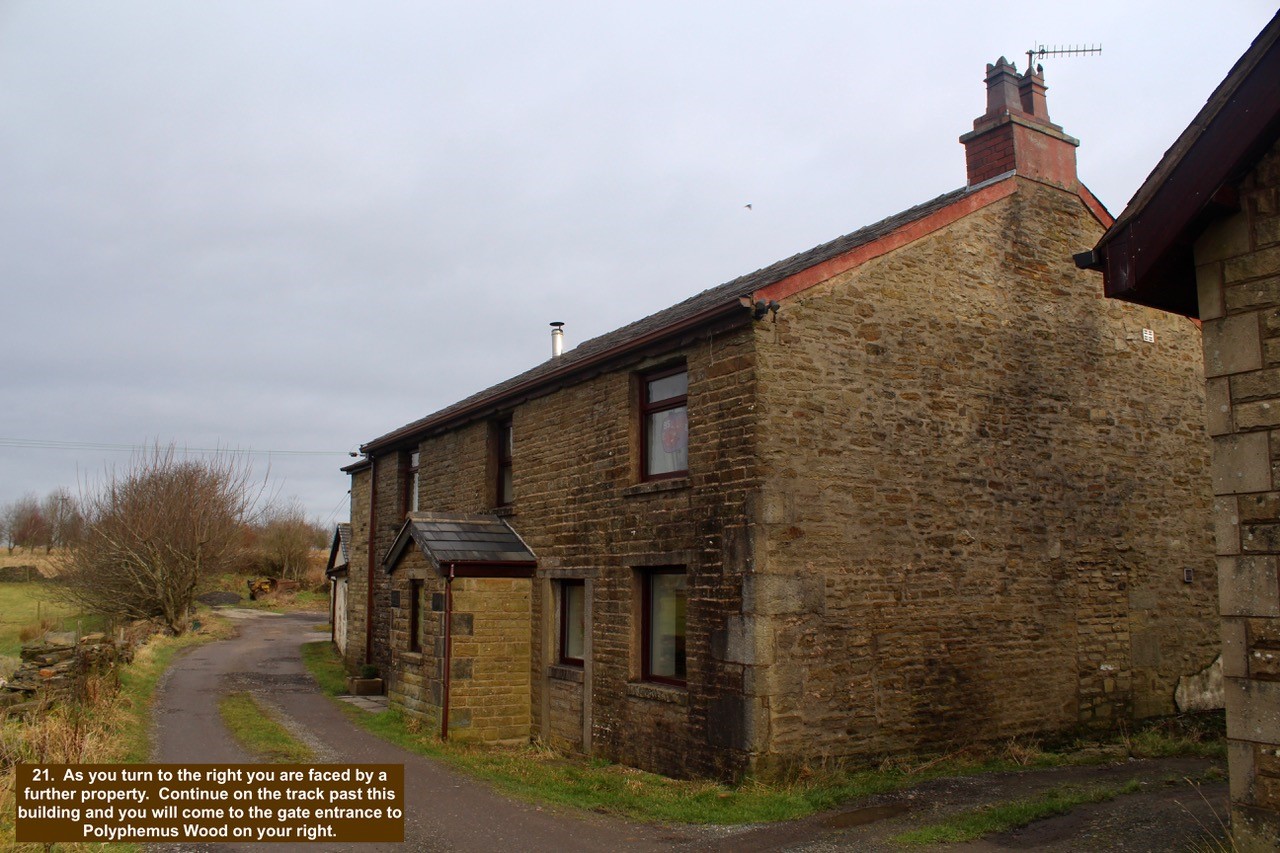
- 21. As you turn to the right you are faced by a further property. Continue on the track past this building and you will come to the gate entrance to Polyphemus Wood on your right.
-

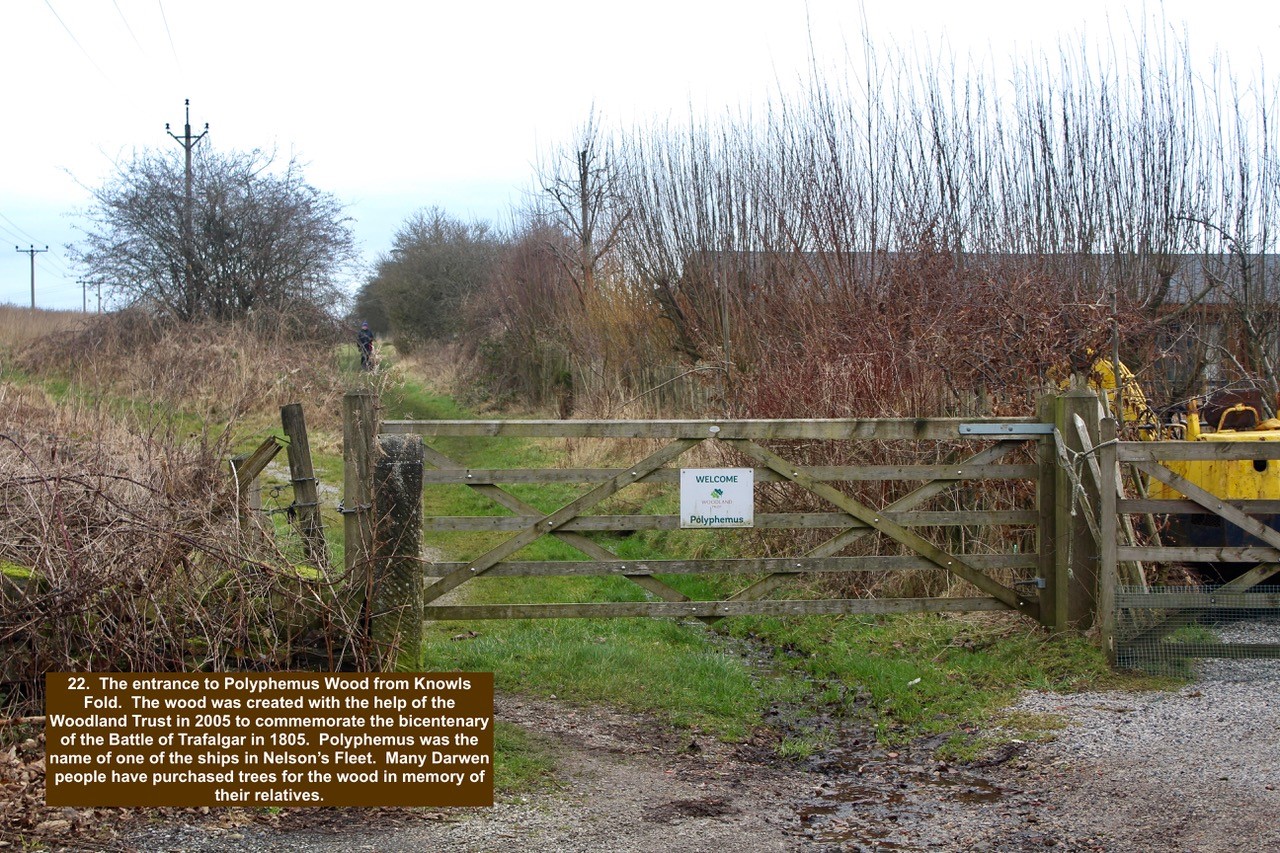
- 22. The entrance to Polyphemus Wood from Knowls Fold. The wood was created with the help of the Woodland Trust in 2005 to commemorate the bicentenary of the Battle of Trafalgar in 1805. Polyphemus was the name of one of the ships in Nelson’s Fleet. Many Darwen people have purchased trees for the wood in memory of their relatives.
-

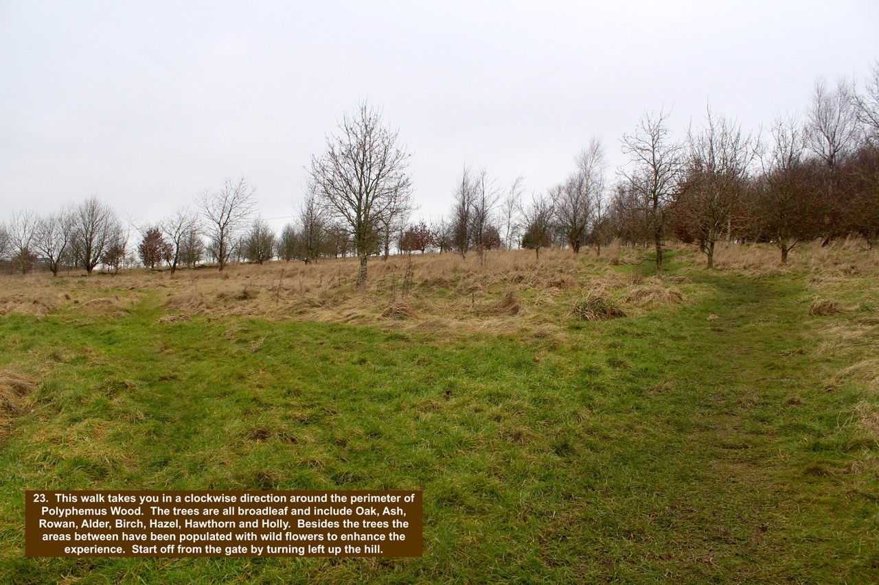
- 23. This walk takes you in a clockwise direction around the perimeter of Polyphemus Wood. The trees are all broadleaf and include Oak, Ash, Rowan, Alder, Birch, Hazel, Hawthorn and Holly. Besides the trees the areas between have been populated with wild flowers to enhance the experience. Start off from the gate by turning left up the hill.
-

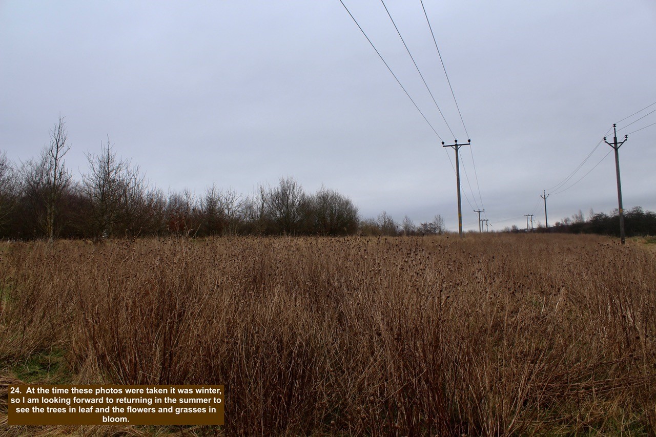
- 24. At the time these photos were taken it was winter, so I am looking forward to returning in the summer to see the trees in leaf and the flowers and grasses in bloom.
-

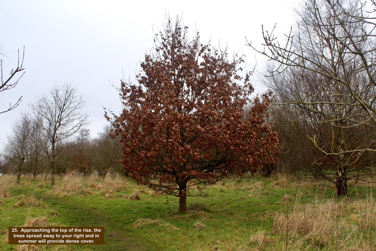
- 25. Approaching the top of the rise, the trees spread away to your right and in summer will provide dense cover.
-

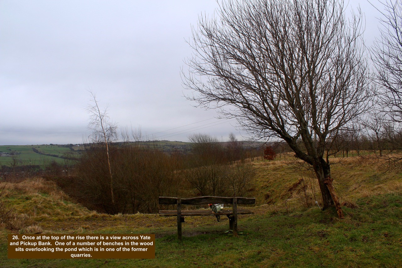
- 26. Once at the top of the rise there is a view across Yate and Pickup Bank. One of a number of benches in the wood sits overlooking the pond which is in one of the former quarries.
-

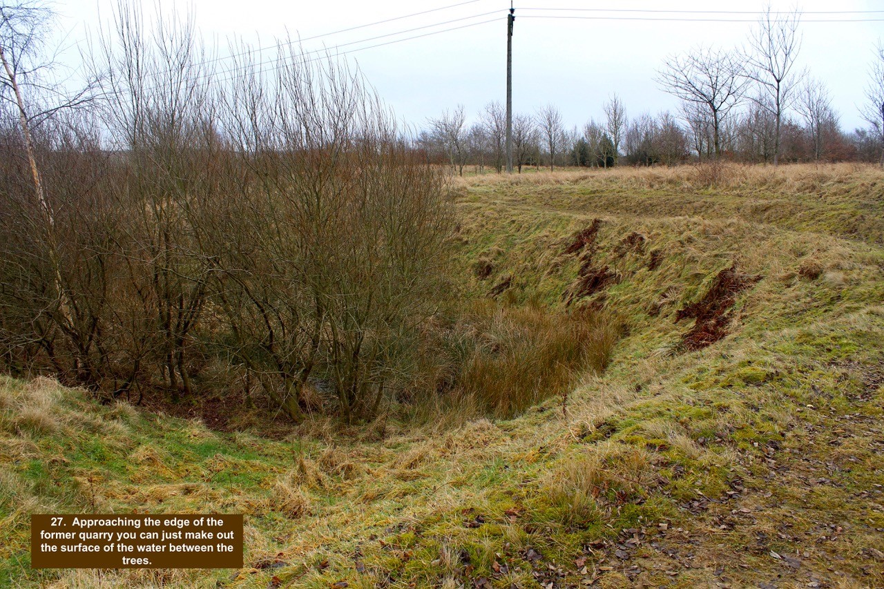
- 27. Approaching the edge of the former quarry you can just make out the surface of the water between the trees.
-

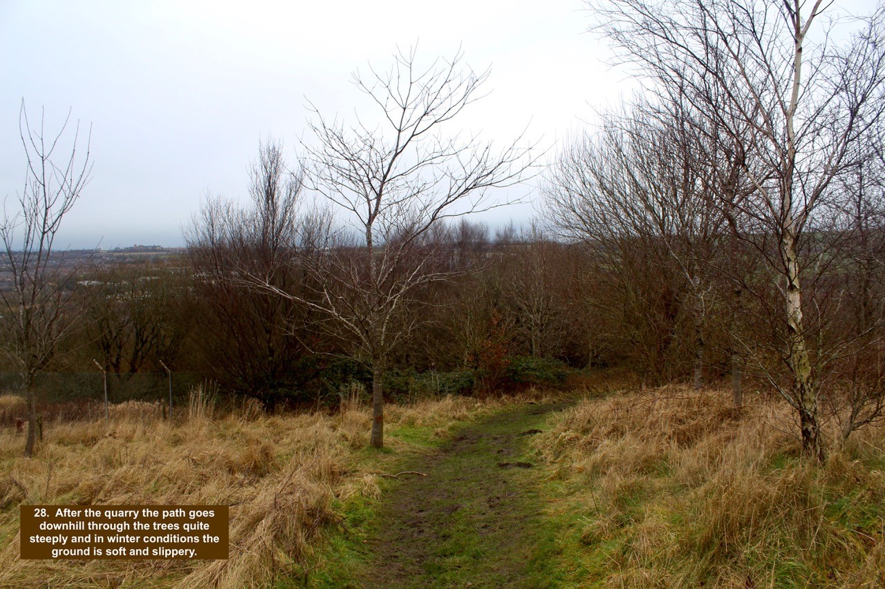
- 28. After the quarry the path goes downhill through the trees quite steeply and in winter conditions the ground is soft and slippery.
-

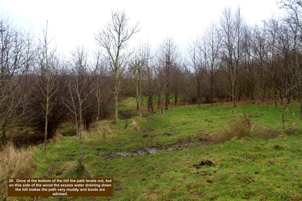
- 29. Once at the bottom of the hill the path levels out, but on this side of the wood the excess water draining down the hill makes the path very muddy and boots are advised.
-

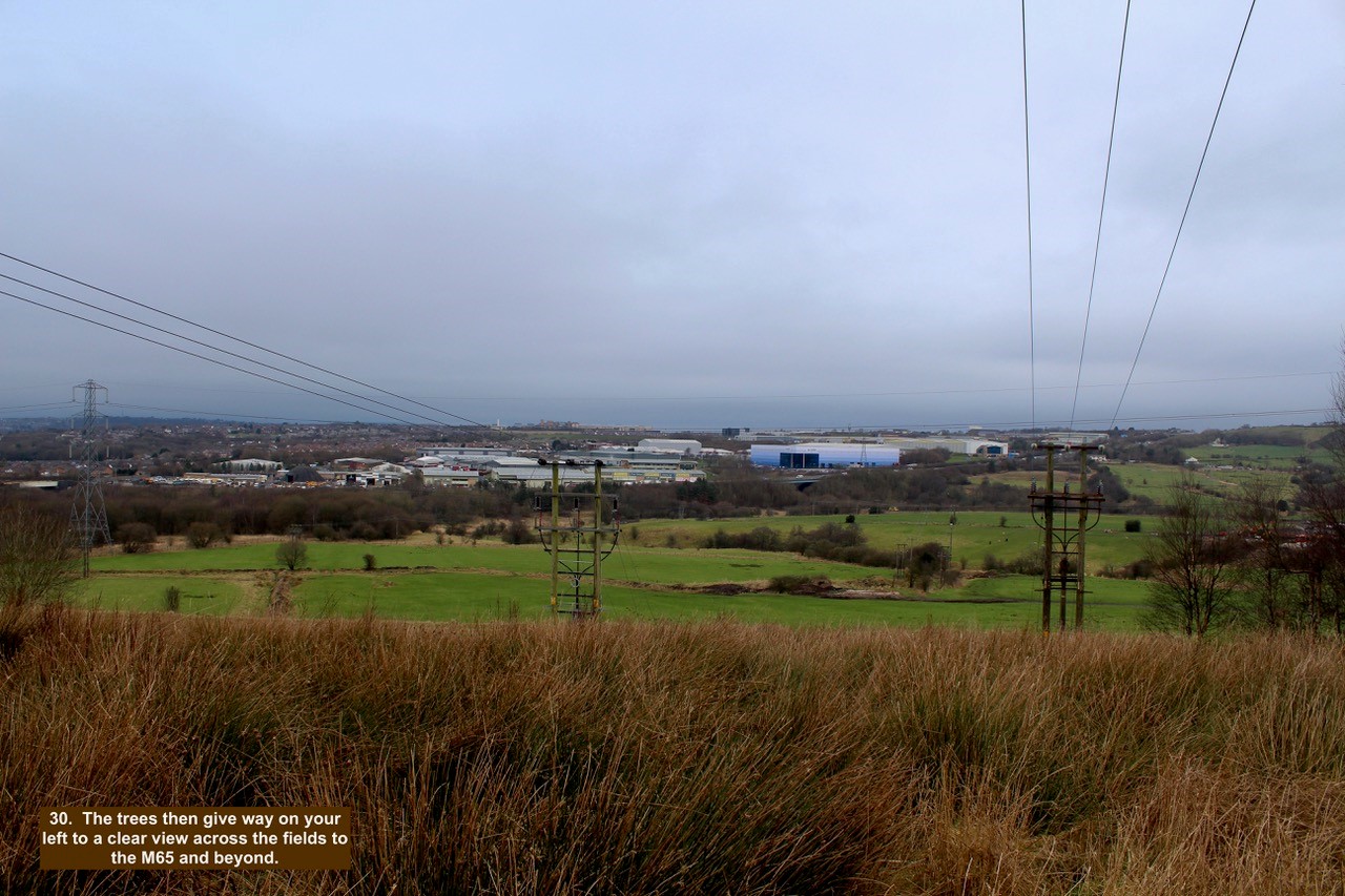
- 30. The trees then give way on your left to a clear view across the fields to the M65 and beyond.
-

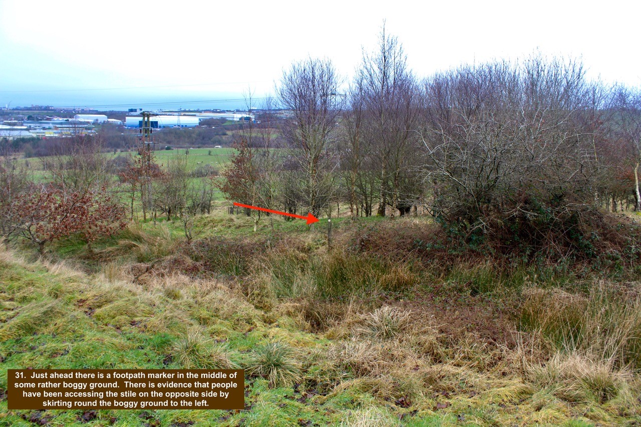
- 31. Just ahead there is a footpath marker in the middle of some rather boggy ground. There is evidence that people have been accessing the stile on the opposite side by skirting round the boggy ground to the left.
-

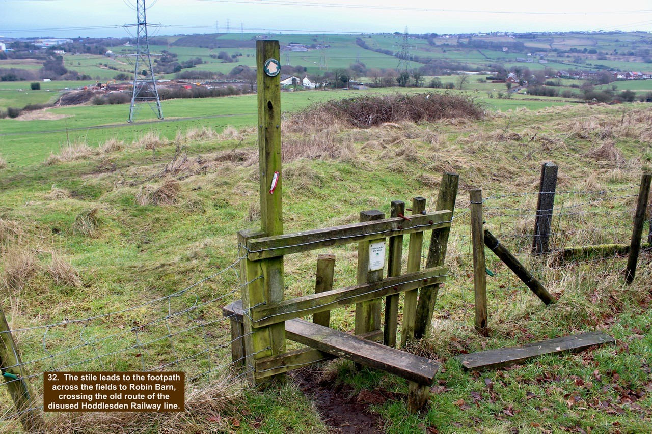
- 32. The stile leads to the footpath across the fields to Robin Barn, crossing the old route of the disused Hoddlesden Railway line.
-

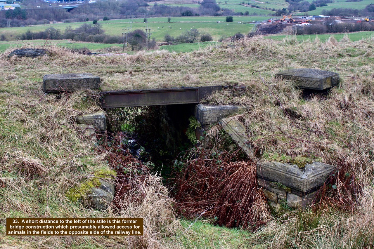
- 33. A short distance to the left of the stile is this former bridge construction which presumably allowed access for animals in the fields to the opposite side of the railway line.
-

- 34. Stay in the wood and continue along the bottom path until you reach the stile for Eccleshill Fold.

-

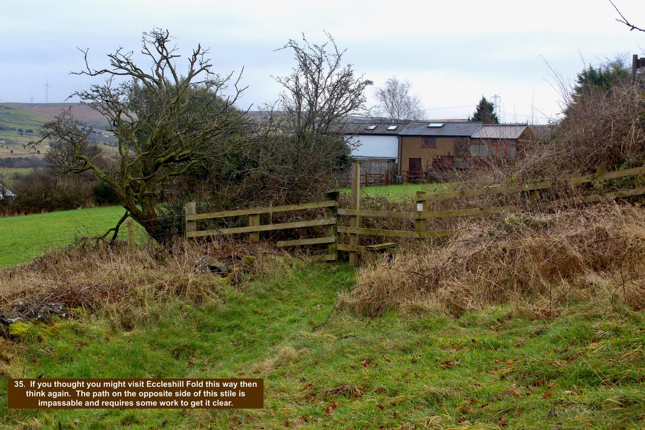
- 35. If you thought you might visit Eccleshill Fold this way then think again. The path on the opposite side of this stile is impassable and requires some work to get it clear.
-

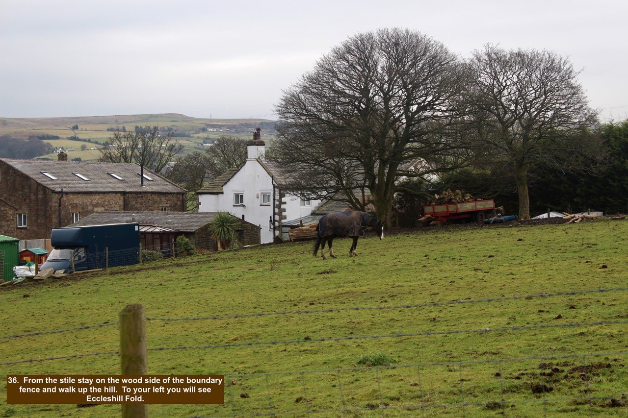
- 36. From the stile stay on the wood side of the boundary fence and walk up the hill. To your left you will see Eccleshill Fold.
-

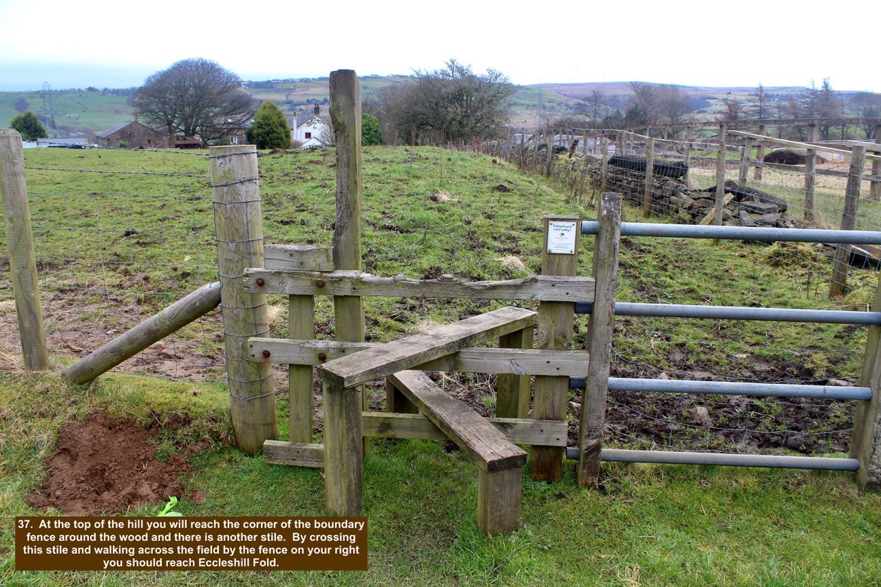
- 37. At the top of the hill you will reach the corner of the boundary fence around the wood and there is another stile. By crossing this stile and walking across the field by the fence on your right you should reach Eccleshill Fold.
-

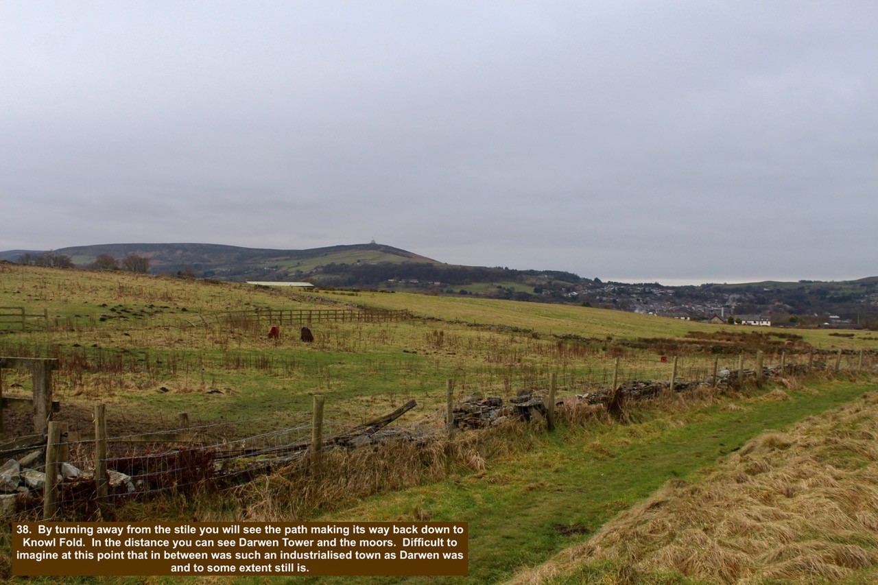
- 38. By turning away from the stile you will see the path making its way back down to Knowl Fold. In the distance you can see Darwen Tower and the moors. Difficult to imagine at this point that in between was such an industrialised town as Darwen was and to some extent still is.
-

- 39. The path on this side of the wood is much easier to walk on and does not suffer from the water draining down the hill.

-

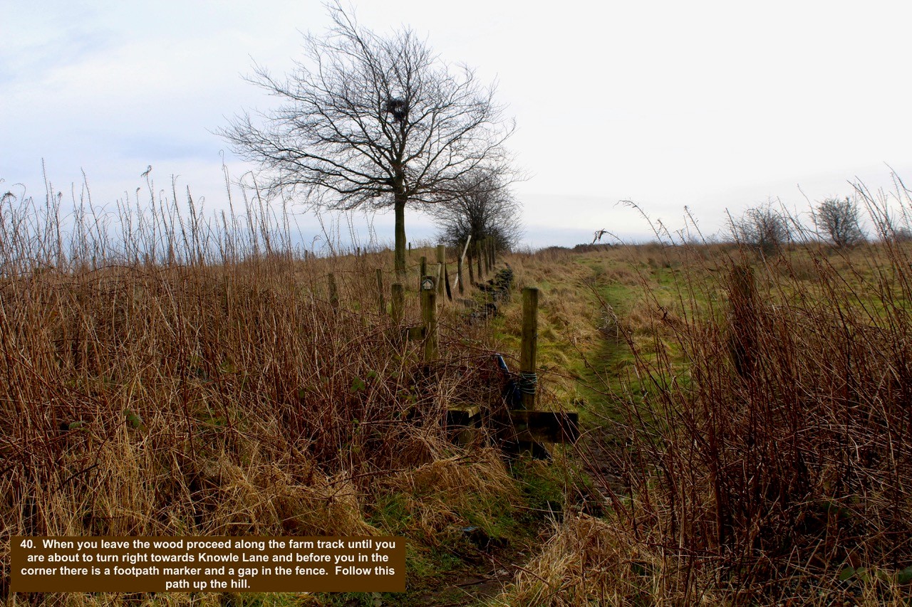
- 40. When you leave the wood proceed along the farm track until you are about to turn right towards Knowle Lane and before you in the corner there is a footpath marker and a gap in the fence. Follow this path up the hill.
-

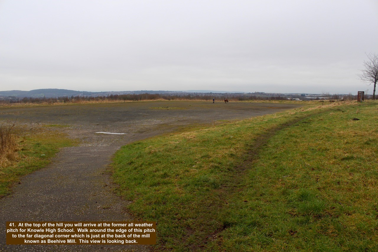
- 41. At the top of the hill you will arrive at the former all weather pitch for Knowle High School. Walk around the edge of this pitch to the far diagonal corner which is just at the back of the mill known as Beehive Mill. This view is looking back.
-

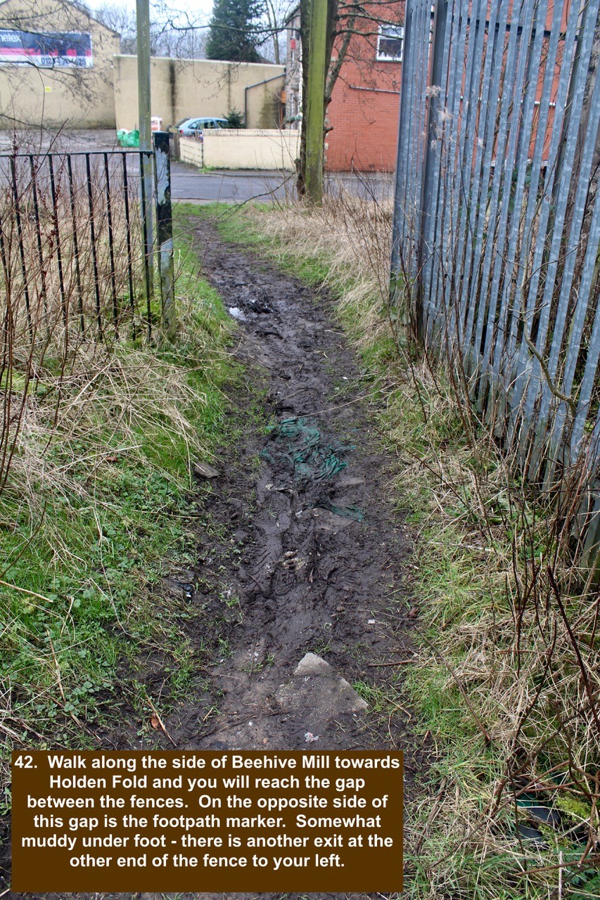
- 42. Walk along the side of Beehive Mill towards Holden Fold and you will reach the gap between the fences. On the opposite side of this gap is the footpath marker. Somewhat muddy under foot – there is another exit at the other end of the fence to your left.
-

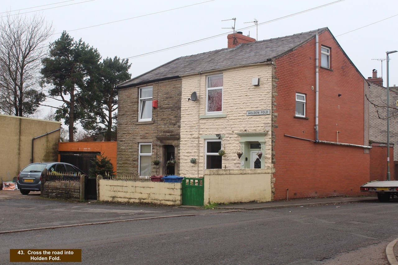
- 43. Cross the road into Holden Fold.
-

- 44. Continue through Holden Fold by walking down the left side of the Metex building.

-

- 45. The ginnel takes you through Holden Fold to Ivinson Road and ahead you can see the back of St James Church.

-

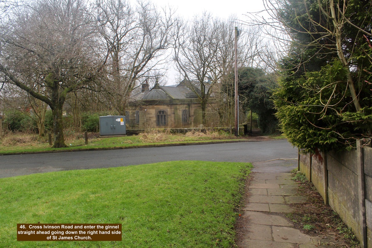
- 46. Cross Ivinson Road and enter the ginnel straight ahead going down the right hand side of St James Church.
-

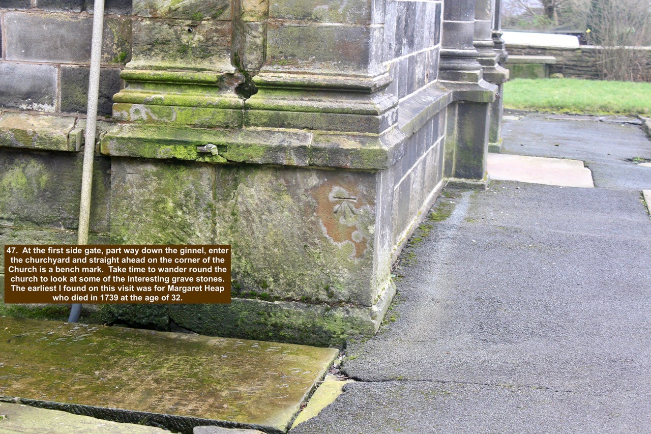
- 47. At the first side gate, part way down the ginnel, enter the churchyard and straight ahead on the corner of the Church is a bench mark. Take time to wander round the church to look at some of the interesting grave stones. The earliest I found on this visit was for Margaret Heap who died in 1739 at the age of 32.
-

- 48. Leave St James Church by the front gate. There has been a church on this site since around 1550/60 and it was formerly known as Darwen Chapel. Once through the gate turn left and then take the first right to go down the hill.

-

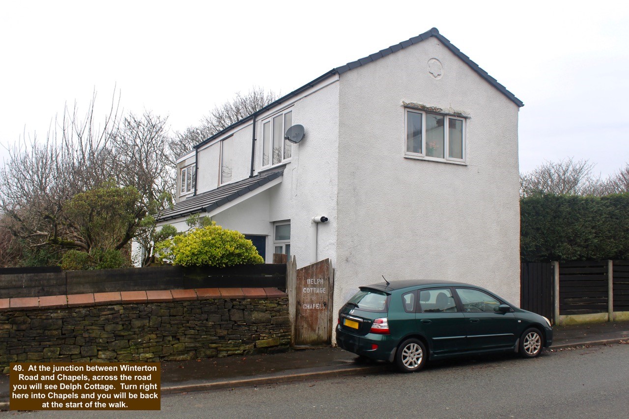
- 49. At the junction between Winterton Road and Chapels, across the road you will see Delph Cottage. Turn right here into Chapels and you will be back at the start of the walk.